Choosing a camera for photogrammetry involves many considerations. Some of the most common considerations include:
- Sensor size in megapixels
- Lens focal length
- Weight
- Price
- Mounting
Some less obvious considerations are:
- Maximum shutter speed.
- Shutter interval speed – allowing image storage and geotagging.
Goals for a photogrammetry mission include a small ground sample distance (GSD) – which is the area of ground captured by a single pixel of the camera’s sensor. A typical goal is to achieve a GSD of 1 centimeter. Photogrammetry with larger GSD’s can be useful – but with smaller a GSD, more precise measurements that can be taken from the model.
A larger MP camera sensor can capture more land area per image – and thus is more efficient. But moderate sensor sizes can be effective. The DJI Phantom 4 – with its 20 MP camera sensor has been a very effective photogrammetry tool. Its sensor size and its range limit it to about 40 acres per mission at 1 cm GSD – so for larger photogrammetry areas multiple missions are required.
Cameras with sensors larger than 100 MP are available – but there are tradeoffs with large sensors. Some photogrammetry software, such as PIX4D, charge more for software to process very large images. And there is a point of diminishing return as large MP sensors capture smaller than 1 cm GSD images at the maximum legal altitudes for sUAV operation.
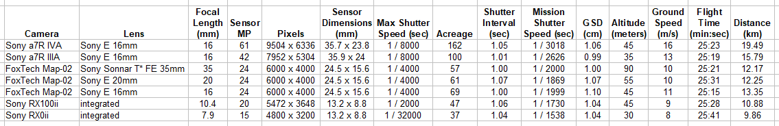
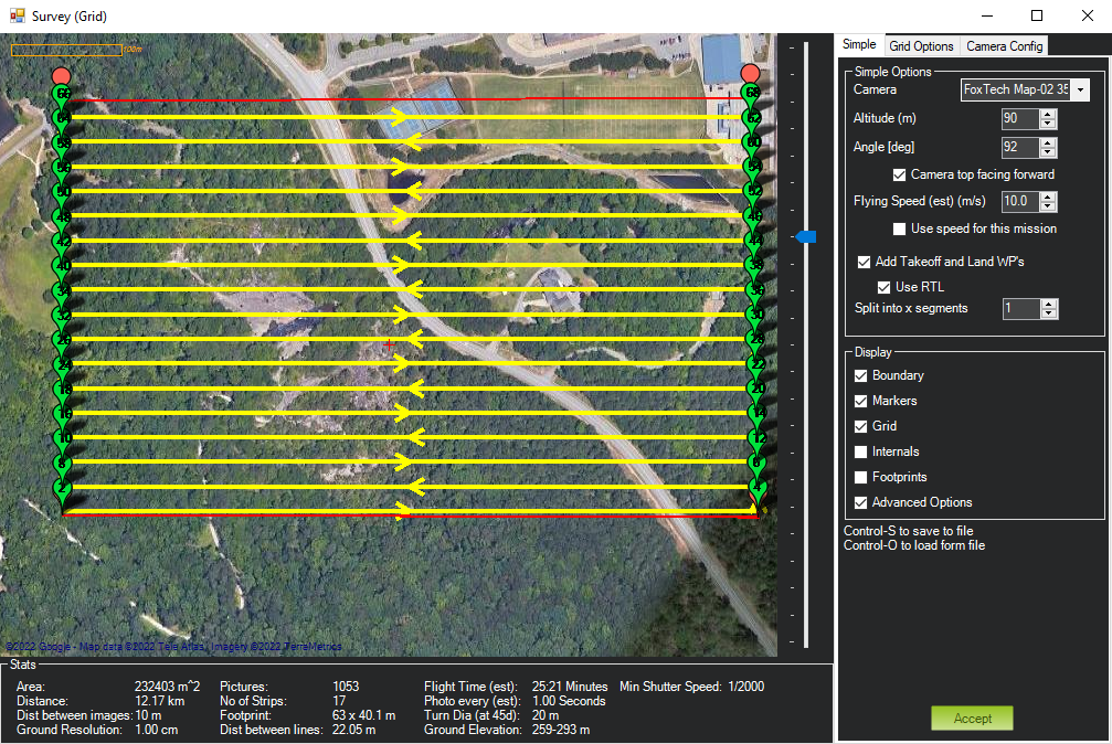
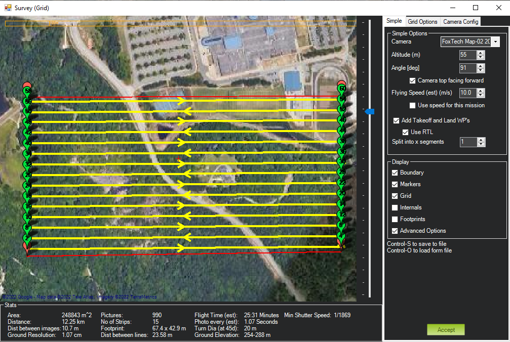
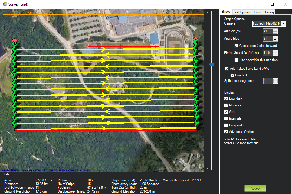
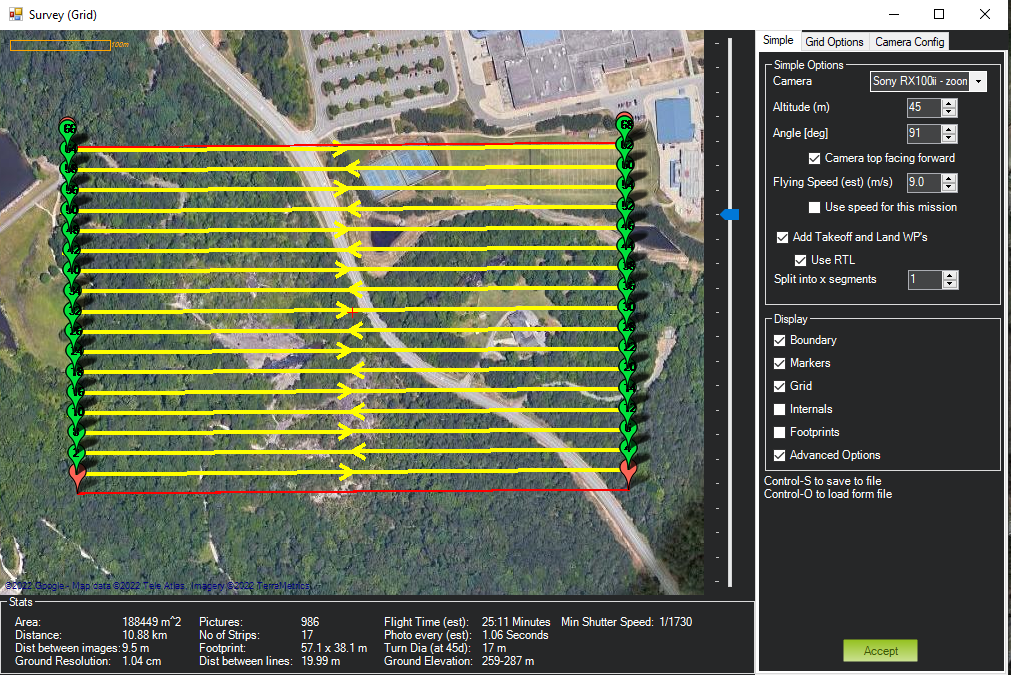
To compare the effectiveness of cameras, I chose 5 typical cameras and constructed optimal photogrammetry missions in Mission Planner to compare them. For one camera, I chose three lenses to show the effect of lens selection.
These missions have two constraints – a GSD of close to 1 cm, and a shutter interval of close to 1 second. With these constraints I determined the acreage that can be covered in a 25 minute mission. The smallest camera, with a 15 MP sensor, can fly a 25 minute mission covering just under 40 acres. The largest camera, with a 61 MP sensor can cover over 160 acres in the same 25 minutes.
I chose a flight speed that limits the shutter interval to 1 second because this is a common practical limit for recording and geotagging images. Some cameras can capture images much faster – and some cameras require 1.5 seconds or more. I chose 1 second because it’s a common limit – and it allows for an even comparison of these cameras.
Generally, higher acreage coverage requires faster flight. Flight altitude depends on both sensor size and lens focal length.
Physically larger camera sensors capture more light per pixel, which may have a positive effect on image quality. But the physically small camera sensor in the DJI Mini 3 Pro has a 48 MP sensor – and from my tests, still produces satisfactory images. Unfortunately, no software exists yet to construct automated photo survey missions for the DJI Mini 3 Pro.
Below is a chart comparing the results of my sample missions.
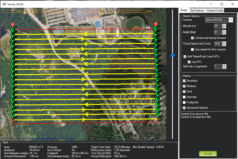
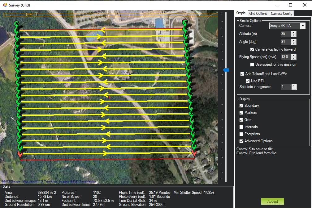
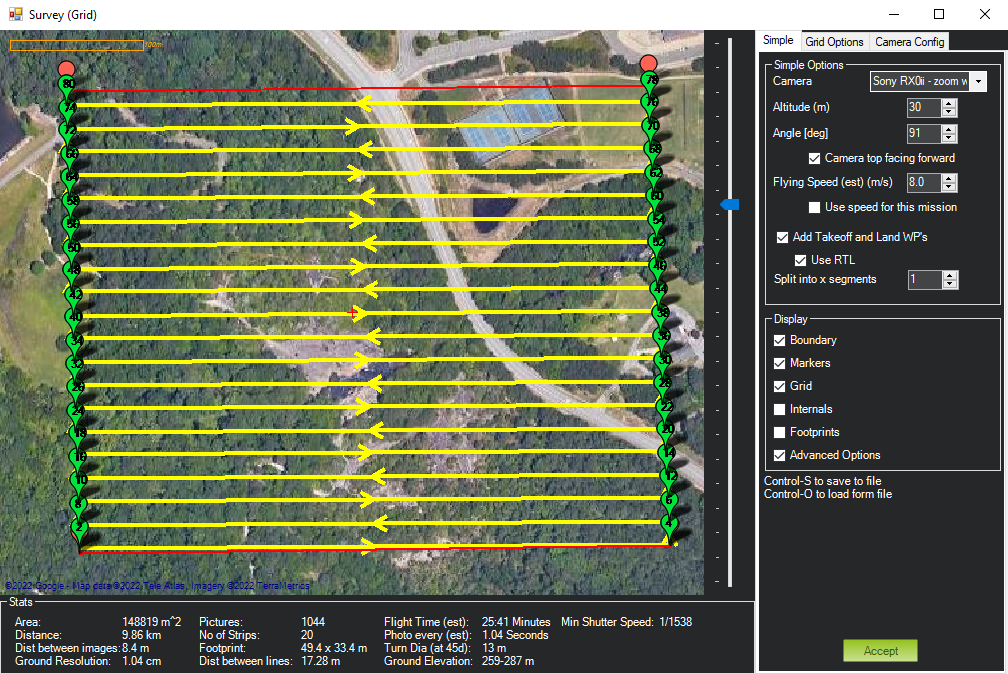
Screen shots from each camera’s sample mission are below.
Very interesting and useful information. Thank you.